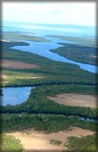
 The Shimba hills are a dissected plateau that ascends steeply from the coastal plains, 30 km south west of Mombasa and just south of Kwale town. The surrounding escarpment rises from around 120m to 300m across the bulk of the plateau and as high as 450m at Marare and Pengo hills.
The underlying rocks are the Triassic Shimba Grits and in the north central part near Kwale town Pliecone Magarini sands. Rivers flowing from the hills supply fresh water to Mombasa and the Diani/Ukunda area.
The Shimba Hills were gazetted as a National Forest in 1903, grassland areas were incorporated in 1924 and several subsequent extensions took place to bring the Reserve to its present size. In 1968 most of the Reserve was double gazetted as the Shimba Hills National Reserve. Two smaller areas to the west adjoining the reserve and almost entirely forested remain as Forest Reserves; Mkongani North and Mkongani West Forest Reserve.
A fenced elephant corridor connects the Shimba Hills with Mwaluganje Forest Reserve to the North.
Shimba Hills National Reserve is located 33 km South of Mombasa, in Kwale district of Coast Province. The reserve’s main access is via Diani. – 56 kms from Mombasa. The reserve has one airstrip.
The climate is hot and moist but is cooler than that at the coast with strong sea breezes and frequent mist and cloud in the early morning. Annual rainfall is 855mm-1682mm. Mean annual temperatures is 24.2 degrees Centigrade.
Major attractions
- Scenic landscape comprising of hills and valleys extending beyond the reserve boundaries,
- Sheldricks Falls,
- Sable antelope,
- Coastal rainforest,
- Potential for bird-shooting outside the Reserve
